Earth Watch Report - Earthquakes
…
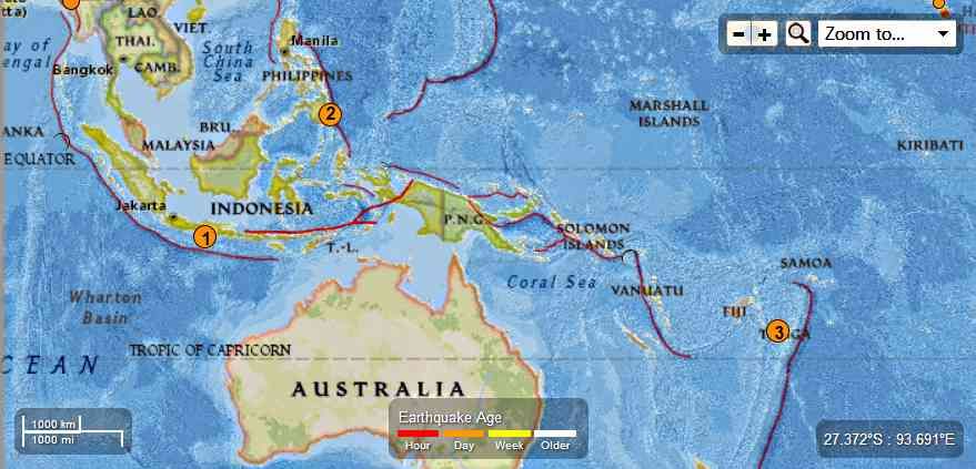
1
M5.3 – 82km SW of Sukorejo, Indonesia
2013-08-08 10:45:57 UTC

Event Time
- 2013-08-08 10:45:57 UTC
- 2013-08-08 17:45:57 UTC+07:00 at epicenter
- 2013-08-08 05:45:57 UTC-05:00 system time
Location
8.825°S 110.909°E depth=9.7km (6.0mi)
Nearby Cities
- 82km (51mi) SW of Sukorejo, Indonesia
- 100km (62mi) SSE of Wonosari, Indonesia
- 106km (66mi) SSW of Jatiroto, Indonesia
- 114km (71mi) SSE of Pundong, Indonesia
- 533km (331mi) ESE of Jakarta, Indonesia
…
2
M5.1 – 42km ESE of Bobon, Philippines
2013-08-08 02:03:08 UTC

Event Time
- 2013-08-08 02:03:08 UTC
- 2013-08-08 10:03:08 UTC+08:00 at epicenter
- 2013-08-07 21:03:08 UTC-05:00 system time
Location
6.718°N 126.680°E depth=179.4km (111.5mi)
Nearby Cities
- 42km (26mi) ESE of Bobon, Philippines
- 57km (35mi) ESE of Mati, Philippines
- 57km (35mi) SSE of Manay, Philippines
- 76km (47mi) ESE of Lupon, Philippines
- 864km (537mi) W of Koror Town, Palau
…
3
M5.0 – 166km NW of Nuku`alofa, Tonga
2013-08-08 04:57:57 UTC

Event Time
- 2013-08-08 04:57:57 UTC
- 2013-08-07 16:57:57 UTC-12:00 at epicenter
- 2013-08-07 23:57:57 UTC-05:00 system time
Location
20.269°S 176.513°W depth=241.0km (149.7mi)
Nearby Cities
- 166km (103mi) NW of Nuku`alofa, Tonga
- 580km (360mi) ESE of Suva, Fiji
- 608km (378mi) SE of Lambasa, Fiji
- 694km (431mi) ESE of Nadi, Fiji
- 873km (542mi) SW of Apia, Samoa
…
…
Related articles


